


Hurricane Hilary is barreling into California at a time when the state is likely to see significant rainfall that would cause catastrophic flooding. Notably, a tropical storm watch was issued for parts of Southern California on Friday 18 August.
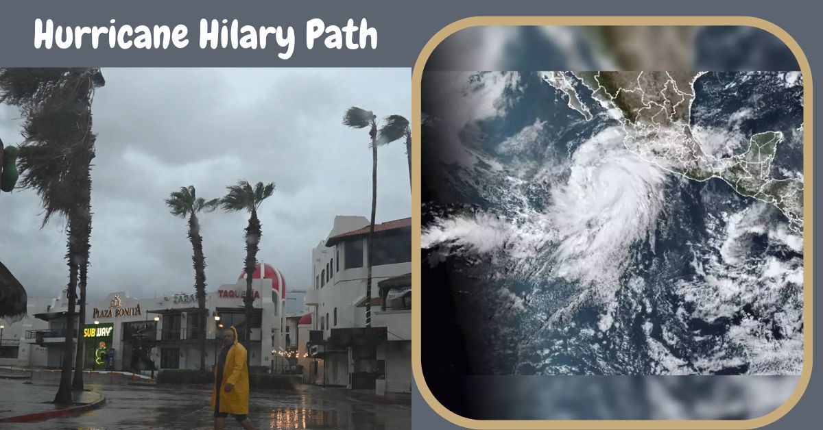
Covering Catalina Island and the area from the California-Mexico border to the line between Orange and Los Angeles counties. On Saturday morning, Hurricane Hilary was about 240 miles southwest of Baja California’s southernmost point.
According to a report in USA Today, the National Hurricane Center has classified Hilary as a “large and powerful” storm with maximum sustained winds of 130 mph. The National Weather Service in San Diego reported that Hilary had accelerated and slightly altered its course to the east early on Saturday.
Therefore, the time when the hurricane will have the most noticeable effects is anticipated to be from Sunday morning till evening. The National Weather Service is encouraging citizens to take measures in light of these circumstances, including locking up valuables in and around their houses and avoiding driving on flooded roadways.
Hurricane Hilary’s Impact on Los Angeles, San Diego

According to meteorologist Scott Homan of AccuWeather, sections of Southern California might start feeling the effects as early as Saturday, despite a tendency that is waning as Hilary approaches.
Homan predicts that rain could start falling in San Diego by Saturday night and that it will probably start raining in Los Angeles on Sunday afternoon. According to Homan’s forecasts, cities including Los Angeles, Anaheim, Santa Barbara, and San Diego could potentially get precipitation of about 4 inches.
Click on the following link if you want to learn more:
While this is happening, desert regions like Palm Springs and the Sierra Nevadas could have rainfall of between 4 and 8 inches. By Sunday afternoon, Hilary is expected to gradually lose strength and change into a tropical storm, according to the report.
Hurricane Hilary Threat to Zion National Park, Death Valley
The Western United States is in danger of flooding this weekend as a result of Hurricane Hilary’s torrential rainfall. This will particularly damage well-known national parks including Utah’s Zion National Park, California’s Joshua Tree, and Death Valley.
The National Weather Service has determined that Zion National Park, known for its dramatic red cliffs and narrow valleys, is particularly susceptible to floods on both Friday and Saturday.
The weather service has given Zion National Park the highest flood potential classification of “expected” for at least the next two days. Other Utah national parks are also at risk of flooding, with the possibility of a deluge being considered significant.
The National Park Service has issued a flood warning just for Zion in reaction to the circumstance. Slot canyons, which are long, slender corridors bordered on either side by rock formations, are advised to be avoided by visitors.
For more details see the tweet below:
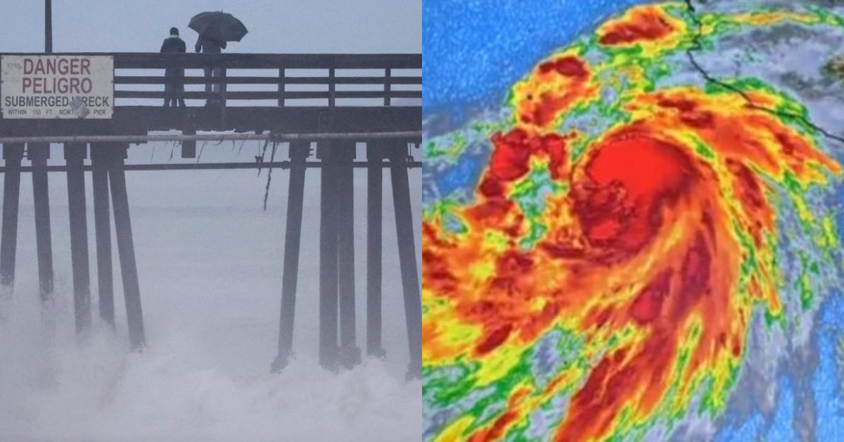
Hurricane #Hilary has sped up a bit, along with a slight shift eastward in its track. This results in Sunday morning through Sunday evening being the time frame of most impact, along with slightly weaker winds.
Stay tuned to @NHC_Pacific & other NWS accounts for updates! #CAwx pic.twitter.com/fR2xRm6h7C
— NWS San Diego (@NWSSanDiego) August 19, 2023
We hope you found some useful information in our article. Share your views in the comments and stay tuned to NewsConduct.com for the latest buzz and current news on your locality.


