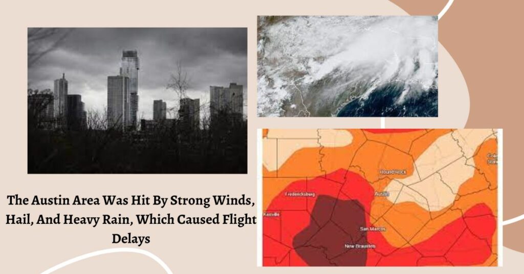
Much of the Austin area is experiencing high winds tonight, and there is a chance of tornadoes and dangerous hail. Between now and 10 p.m. on Friday, the National Weather Service predicts that Travis and Williamson counties may experience winds of more than 60 mph, hail, and a remote risk of tornadoes.
The biggest risk for strong winds and potential tornadoes, according to the NWS, is in the region northeast of Austin and Georgetown. The Federal Aviation Administration temporarily suspended arriving and departing planes at Austin-Bergstrom International Airport as a result of the storm, but the directive was revoked just before 9:30 p.m.
You can also check
- Person Dies After Being Hit By An LIRR Train Near Southold: MTA
- Biden Says That Wind And Solar Power Will Be Used Instead Of Coal At Coal Plants All Aross America.
The probability of floods is modest, according to forecasters. Just before 7 o’clock in the evening, severe thunderstorms moved into the Austin region along the I-35 corridor. After eight o’clock on Friday night, the National Weather Service anticipates storms to form fast and move eastward.
7:04 PM: The severe threat will be diminishing for most of the area as this line moves through. Could see some small hail and gusty winds, but we will clear out once the cold front moves through. Tornado Watch will expire at 8 PM. #dfwwx #ctxwx #txwx pic.twitter.com/aekTmC4Jiw
— NWS Fort Worth (@NWSFortWorth) November 5, 2022
“An isolated tornado or two,” according to the NWS, are conceivable but less likely. The agency first predicted a tornado risk for portions of Austin and Georgetown, but it later updated its prediction, dropping the level of risk for the Austin region from level 3 to level 2 on a scale of 1 to 5.
According to NWS meteorologist Andrew Quigley, much of Central Texas is still in for some severe weather despite the decreased tornado risk.
Isolated thunderstorms are possible again today across much of the area. Impacts with any storms that develop will be lightning, small hail, gusty winds, & brief heavy rain as well as brief heavy snow for elevations above 3500-4500 ft. When thunder roars, go indoors! #CAwx pic.twitter.com/nmR8miKxNm
— NWS Sacramento (@NWSSacramento) November 2, 2022
He declared, “The risk is still present. “Still a possibility along the front, any of those storms could bring strong to severe weather. Damage-causing straight-line winds up to 60 mph would be the main issue. However, there is also a danger of isolated tornadoes and huge hailstones, up to the size of a quarter.”
You can also check
- Person Dies After Being Hit By An LIRR Train Near Southold: MTA
- Gold& Gym Owner Rainer Schaller And 5 Other people Are Thought To Have Died In A Plane Crash In Costa Rica
“There has been a fairly constant signal over the past 48 hours that it will be someplace around the I-35 corridor. We don’t fully know yet if it is just to the west, just to the east, or simply directly on top of “said Quigley. So, simply keeping an eye on the surroundings this afternoon will take care of the problem.
Final Lines:
Hope you find our post valuable for you… Many thanks for taking the time to read this! If you appreciate it, please leave a comment and share it with your friends. There are other articles available on newsconduct.com


